May 12, 2017: Keeping to the coast, we left Florida and explored a bit of Georgia.

The geography of Georgia and the Carolinas is characterized by the Appalachian Mountains in the west, a region of foothills extending east roughly halfway to the Atlantic, then dropping dramatically along what is called the fall line, down to coastal plain. The coast here is typically made up of barrier islands protecting marshland, broken up by numerous inlets and rivers. Most towns in the region were founded on the banks of these rivers, close enough to the sea for easy access, but behind the barrier islands for protection from storms.
Our first Georgia stop was in such a river settlement, St. Marys, a small town that serves as the gateway to the Cumberland Island National Seashore, a barrier island accessible only by boat. Once wholly private property (and largely owned by the Carnegie family in the 20th Century), the federal government began acquiring land and established the National Seashore in 1972. There are still private landowners on the island, but the majority is now wilderness.
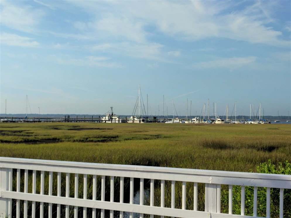
For such a small town, there is a surprising amount of tourism here, presumably because of the proximity to Cumberland. St. Marys (Yes, no apostrophe. Bugs us too.) generously lets RVs park right in the center of town on the waterfront, for up to 48 hours, for free. This was our evening and morning view from our spot:

We enjoyed the St. Marys History Walk and its small Submarine Museum. Sorry, we didn’t get any pictures of the actual town. Trust us, it’s nice. We decided not to invest the time and resources into a trip to Cumberland Island, knowing that we would be seeing a lot of other seashore soon, even if not quite so pristine.
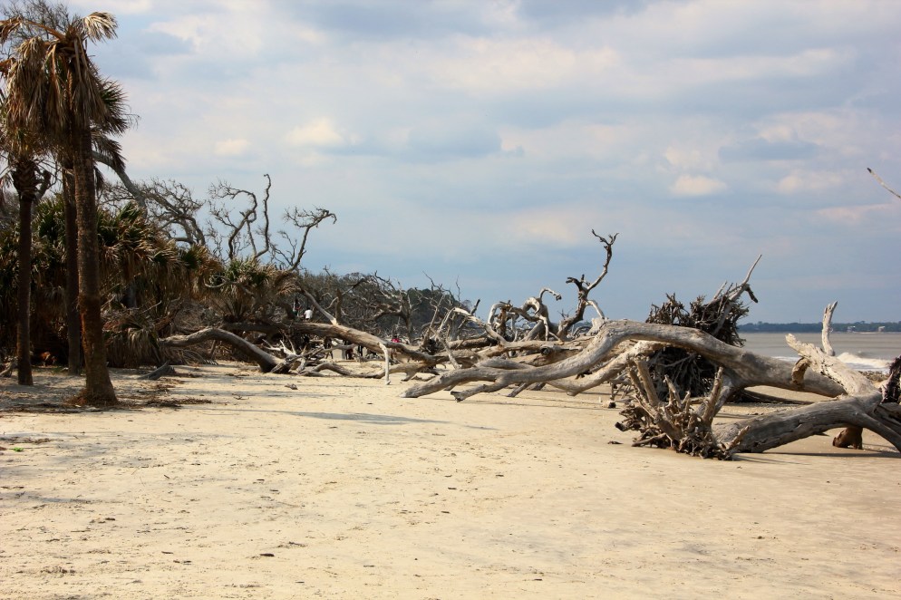
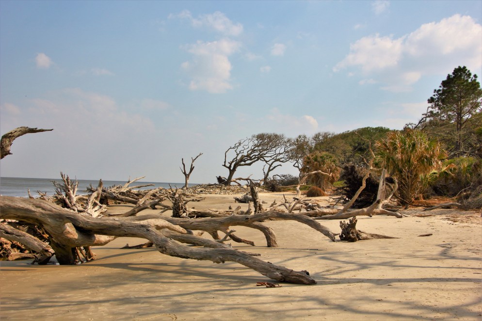
Continuing north along the coast, we next visited Jekyll Island, another barrier island, this one accessible by car. We were there at low tide, resulting in an expansive beach. Warnings here about rapidly rising tides over sand bars make it clear that conditions change dramatically with the shifting tide.


This driftwood beach was scenic:
Inhabited by British settlers as early as the mid-1700s, the Jekyll Island Club purchased the island in 1886, turning it into an exclusive hunting lodge for the ultra-wealthy. Members included some of America’s most recognizable elite of the time, like J.P. Morgan, Joseph Pulitzer, William K. Vanderbilt, Marshall Field, and William Rockefeller. (Not the Carnegies, apparently. After all, they had Cumberland Island to the south almost to themselves.) These magnates constructed ridiculously huge “cottages,” a hotel and club house, and other necessary small town essentials, some of which still stand today. All of this inhabited a discrete little town site, while the rest of the island remained protected for hunting and other activities.
The club fell out of favor after WWII and the State of Georgia purchased the island for use as a state park. Information on the island indicates that many of the club’s “cottages” were simply abandoned, still full of their furnishings. There’s no accounting for the actions of rich people.
Today, the club grounds are a protected tourist attraction, which to us evinced a strange and almost reverential fascination with the way these super rich people vacationed here for a couple of decades. Maybe a little thin in its “historical” value, especially considering the history all around, but we suppose Americans are always fascinated by the lives of the rich and famous.
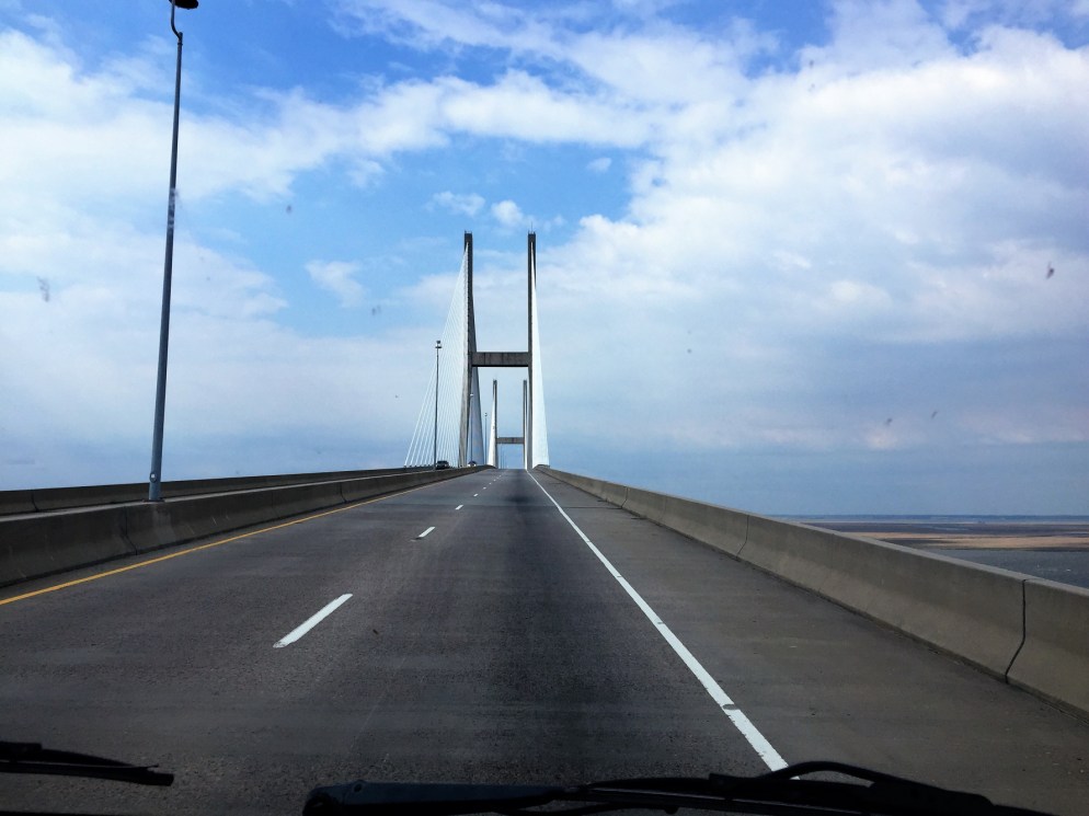
We next visited St. Simons Island, heading north up the coast. Getting there required crossing this bridge. Unsurprisingly, there have been a lot of very high bridges as we have followed the coast and crossed rivers near their mouths, all the way from Texas. Navigating our house across these bridges in high wind is definitely an exhilarating experience.
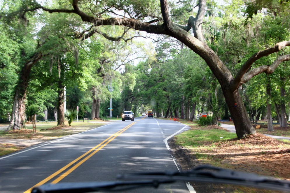
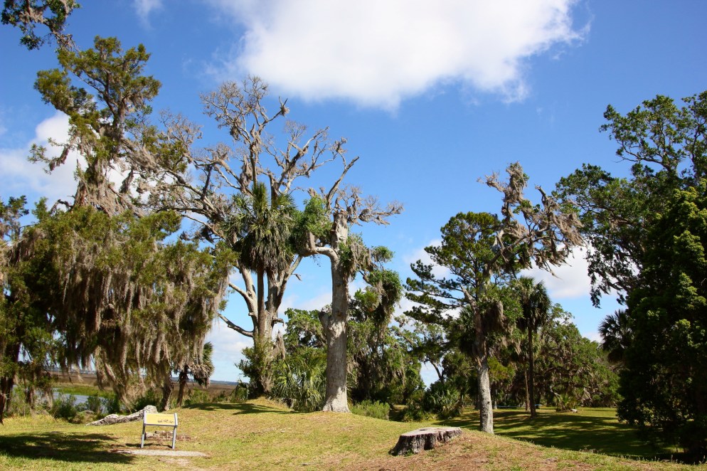
Like many places during this phase of the adventure, Saint Simons has lovely live oak-lined roads. In fact, much of this town feels like it was tunneled out of a dense forest.
We spent the night in a small public access parking lot right on the beach in a quiet residential neighborhood.
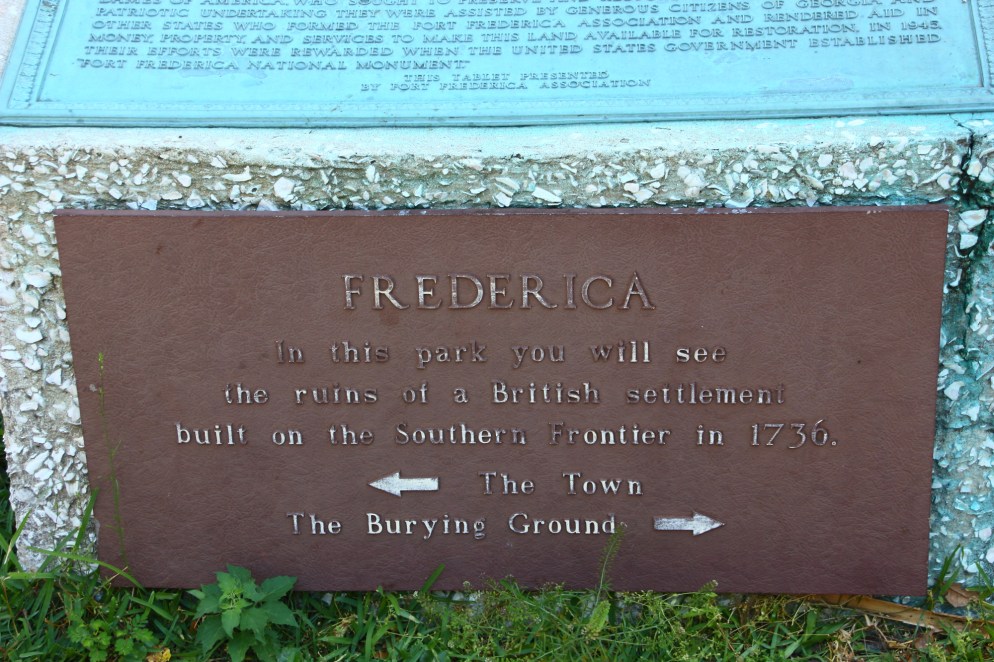
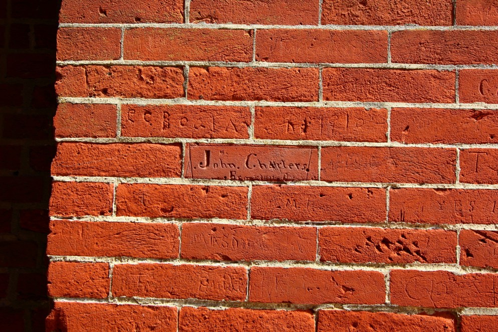
Saint Simons Island is home to Fort Frederica, established by the British in 1736 to protect the new colony of Georgia from Spanish-controlled Florida. Sixty miles south of Savannah, Frederica was set up as the military headquarters of Georgia. The Georgians here at Frederica successfully defended against an attack by Spanish forces out of St. Augustine in 1741. The British and Spanish entered into a peace treaty in 1748; after that the fort and accompanying town were soon abandoned. Today, only ruins remain.
Here settlers utilized “tabby” to construct walls. It’s essentially a form on concrete with crushed oyster shells used in place of gravel or other rock.


Lots of colonial buildings were built of tabby. Apparently, there were giant mounds of oyster shells all over the beaches, artifacts of millennia of human-mollusk interaction.
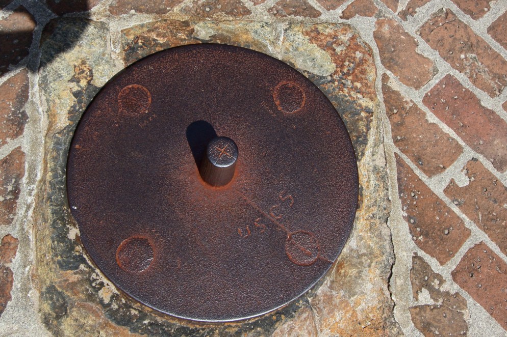
Archaeologists have uncovered foundations from many of the original homes of Frederica. The park service does a nice job of providing information about who lived in each of these homes and explaining what the structure was like, based on ample written records.

In this one, the candle maker’s house, remains of a two-sided fireplace are visible.

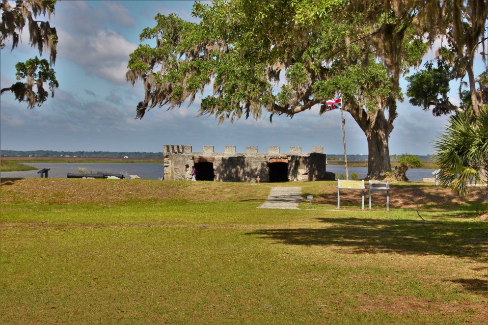
The entire town had a moat and earthen and wooden walls. On the river, the town was protected by a small fortification. Today, the most protected portion, the magazine, is all that stands:
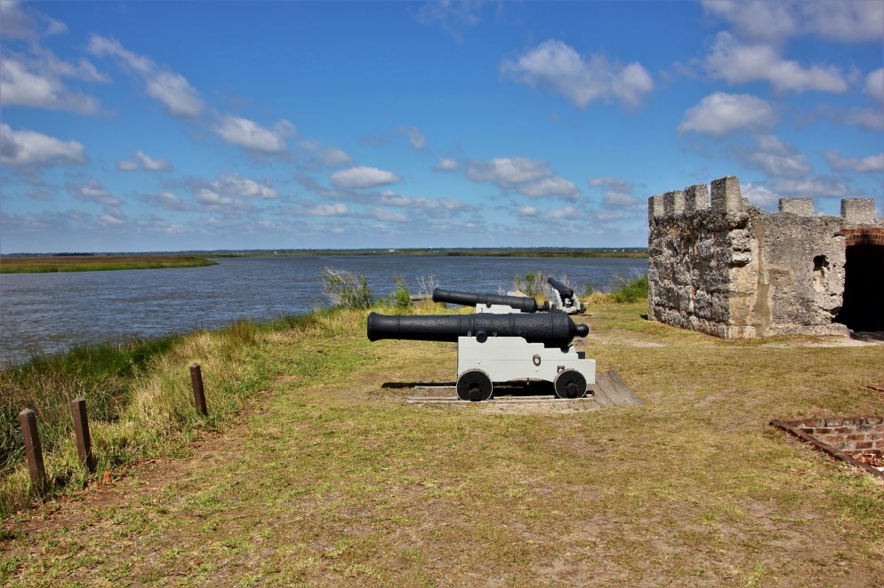
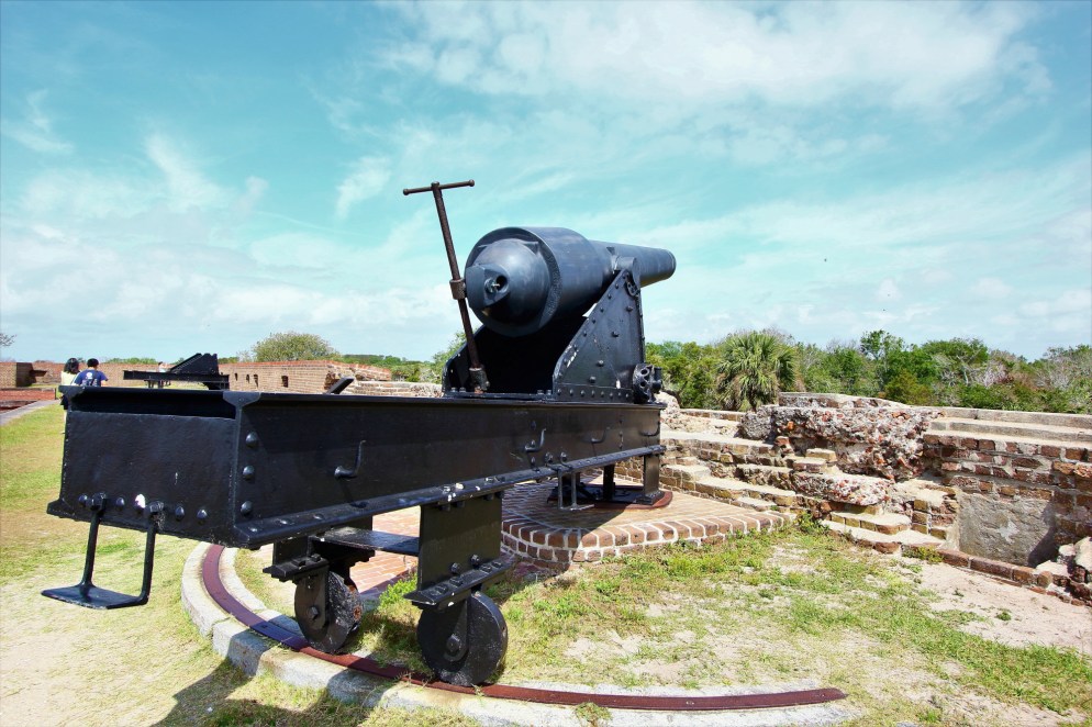
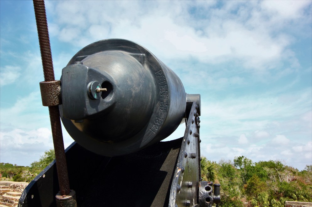
One of these canons is original to the site.
Within the walls of the fort, this was the site of the town’s blacksmith shop.
This is the ruin of the soldiers’ barracks, the other well fortified construction in the town.

This is the town’s burial ground. We found no explanation for the above-ground burials.

For a place where nothing remains but a handful of ruined buildings and foundations, we found this site surprisingly interesting.
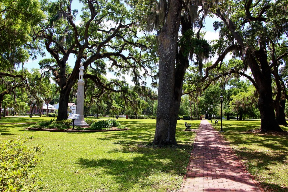
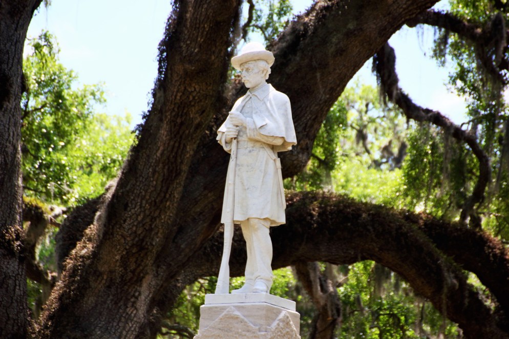
Next we visited Brunswick, Georgia. Brunswick lies on Fancy Bluff Creek (actually a fairly large river-estuary), inside the protection of Jekyll Island and Saint Simons Island. Like Savannah, Brunswick is laid out around a series of town squares.
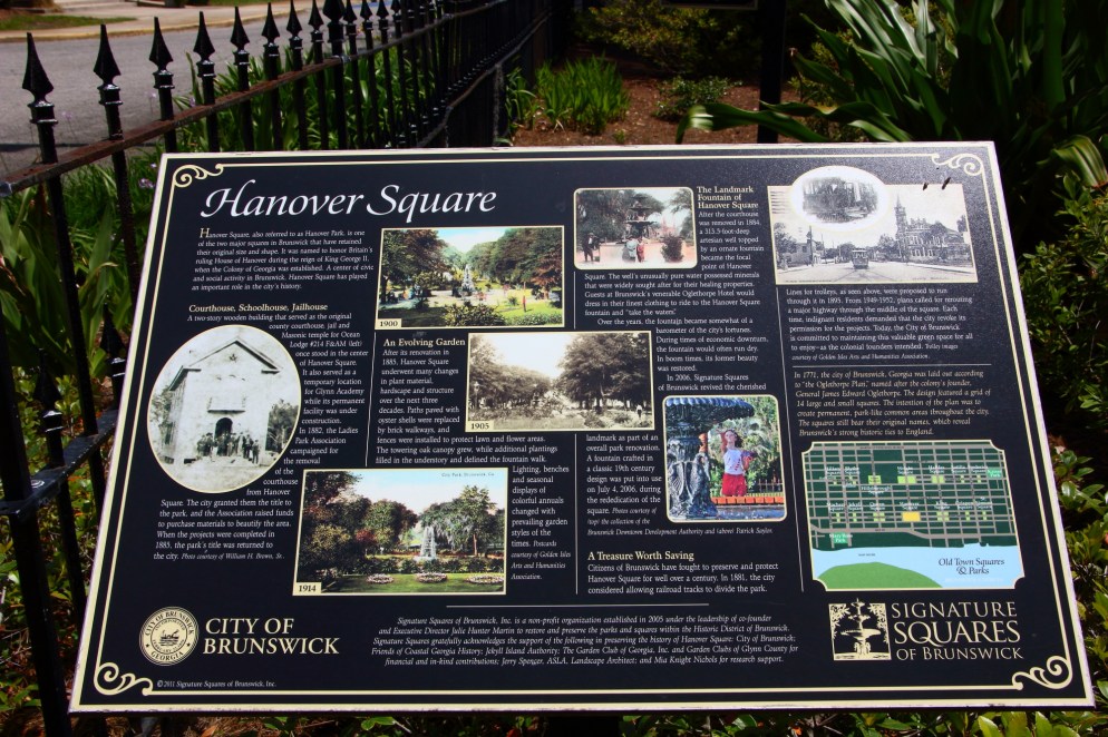
Unlike Savannah, those squares are not full of tourists on walking tours.

As you can see from the sign above, Brunswick has done a great job providing tourists with information about their town. Every square had at least one sign like this providing information and pictures about the square and surrounding blocks through the history of the town.
It was a nice quiet place to spend an afternoon. We also had lunch at the not photographed Tipsy McSways. After walking all around the town, the air conditioning was welcomed. We planned to see the Southeast in the Spring before it got hot. Well, that was the idea, anyway. . .
Finally, we arrived in Savannah. It wasn’t all picturesque squares.

But there were plenty of those too.

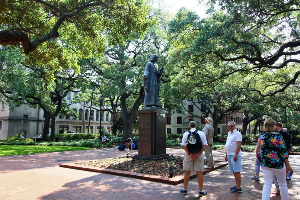
We took a walking tour of the historic district, taking in some history and more picturesque squares with Savannah Dan. That’s seersucker, of course. We wish we’d asked him how many seersucker suits he has.

This downspout is called a dolphin spout, named after the dolphin fish, not the marine mammal.


James Oglethorpe, founder of the Georgia Colony, not only built and defended Fort Frederica, he also planned Brunswick and Savannah, with their profusion of squares (and probably other towns, we would assume). Originally the squares would have been simply open lots. The beautiful parks with their sheltering oaks, benches, and flowers are a more recent redesign.
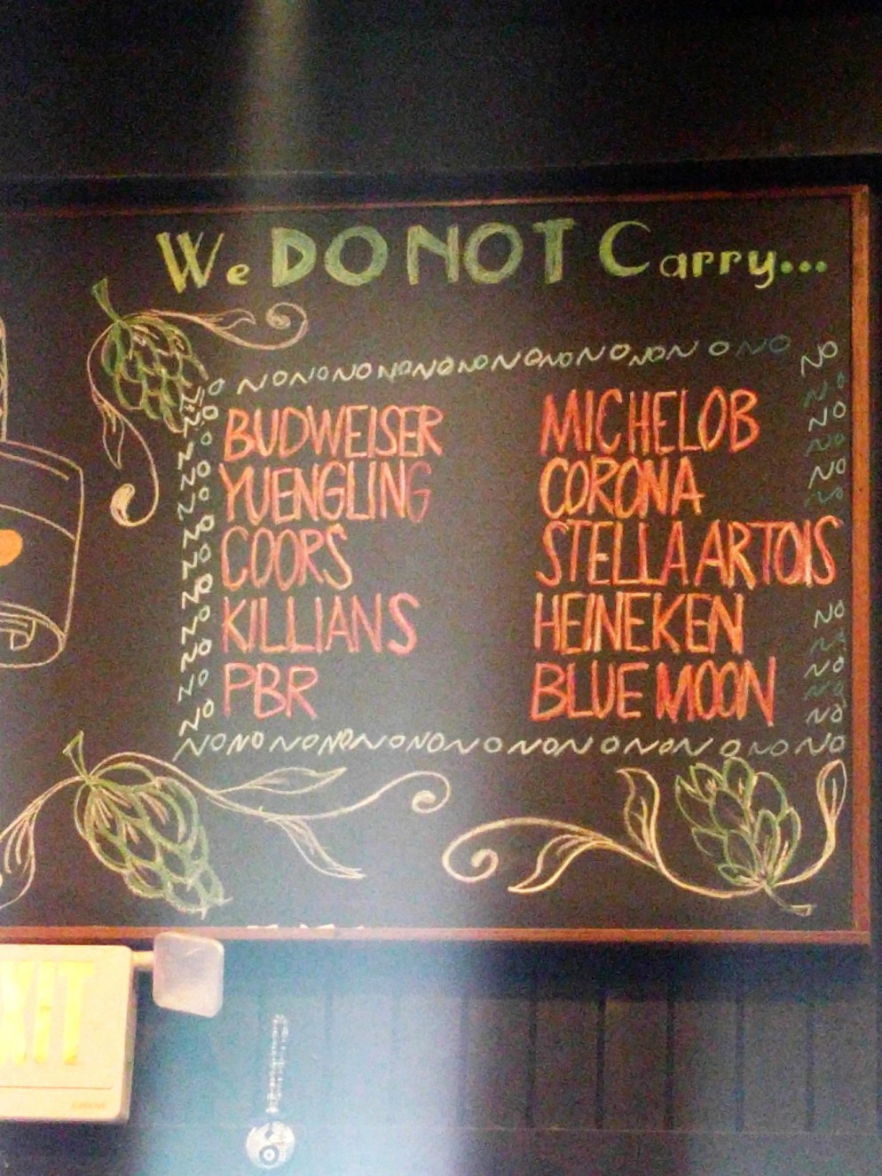
Perhaps predictably, we found a beer bar with an attitude we liked.
Savannah’s Cathedral of St. John the Baptist is not much to look at from the outside. Inside, it’s surprisingly beautiful. Though some of the decoration utilizes less expensive methods (e.g. columns painted to look like marble), the overall effect is lovely. [click to enlarge]


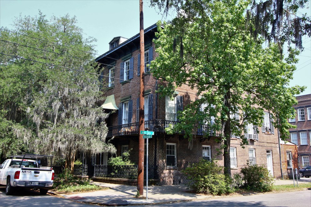
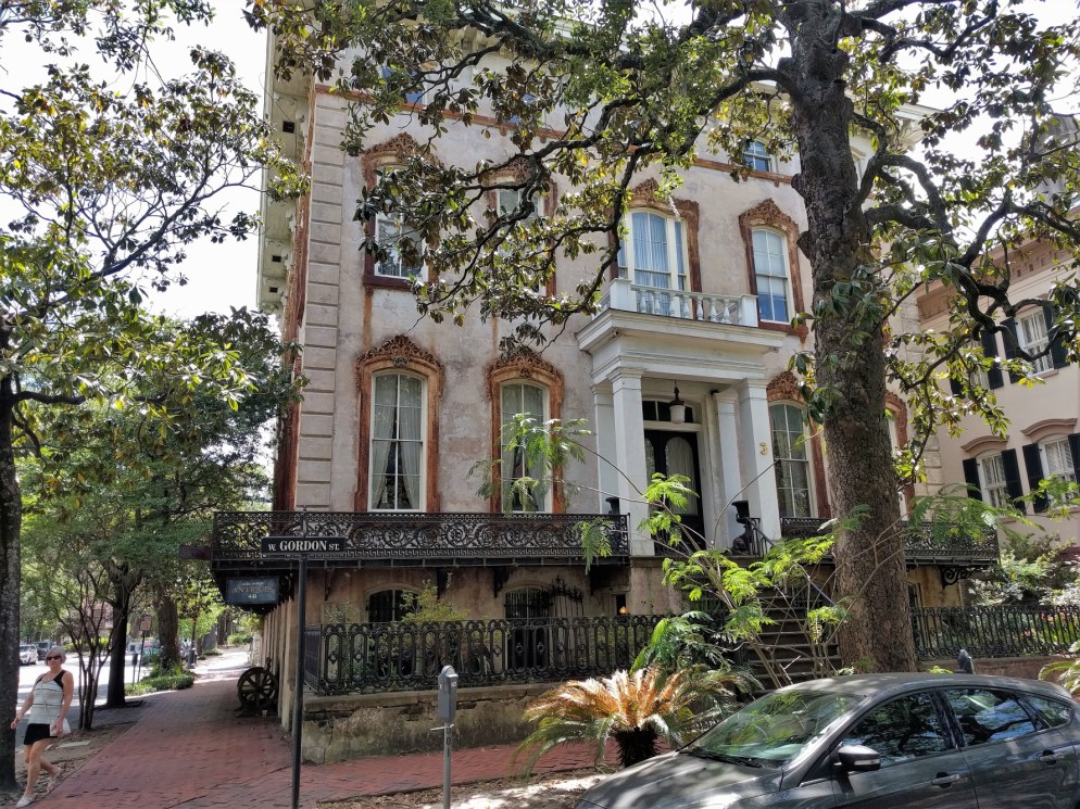
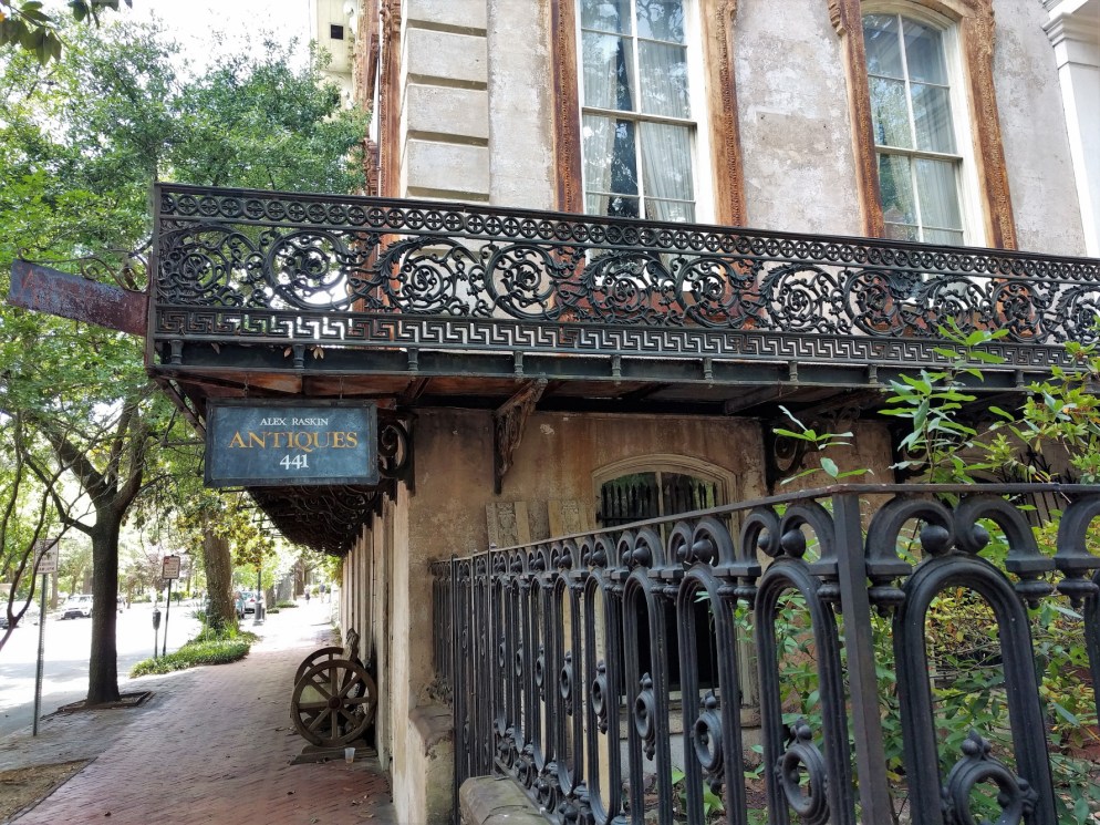
The historic district of town is full of homes like this, all quite picturesque.
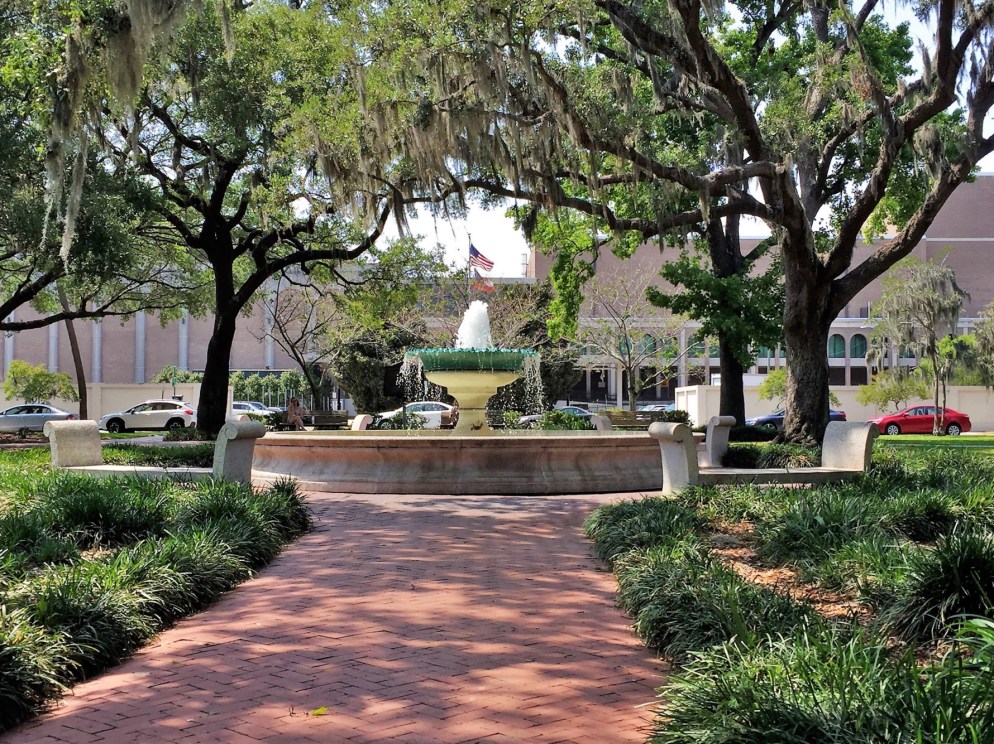
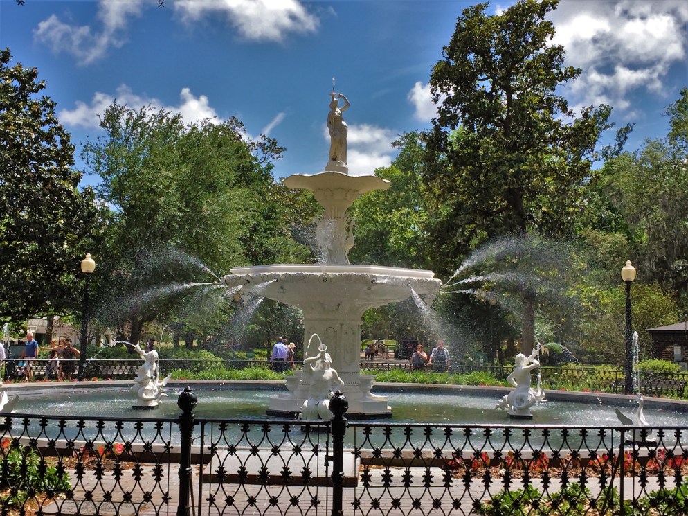
This is the often photographed fountain in Forsyth Park.
Something surprising about Savannah is its attitude toward RVs. As mentioned in our last post, an increasing number of communities don’t want RVs parking anywhere but RV parks. Not Savannah. They have a visitors center on the edge of this historic district with a large parking lot. There RVs can park overnight for $7. We had lots of neighbors, including a gentleman from Quebec who wanted to express his bafflement regarding the U.S. political situation.
We liked Savannah alright, but it didn’t live up to the hype for us. That happens.
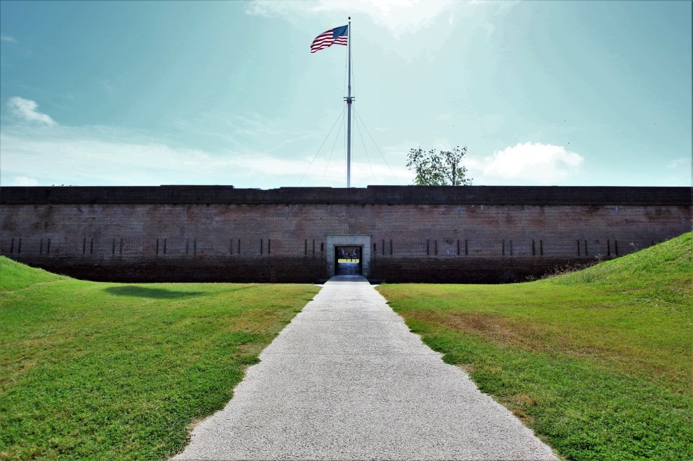
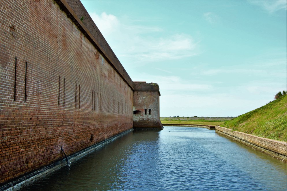
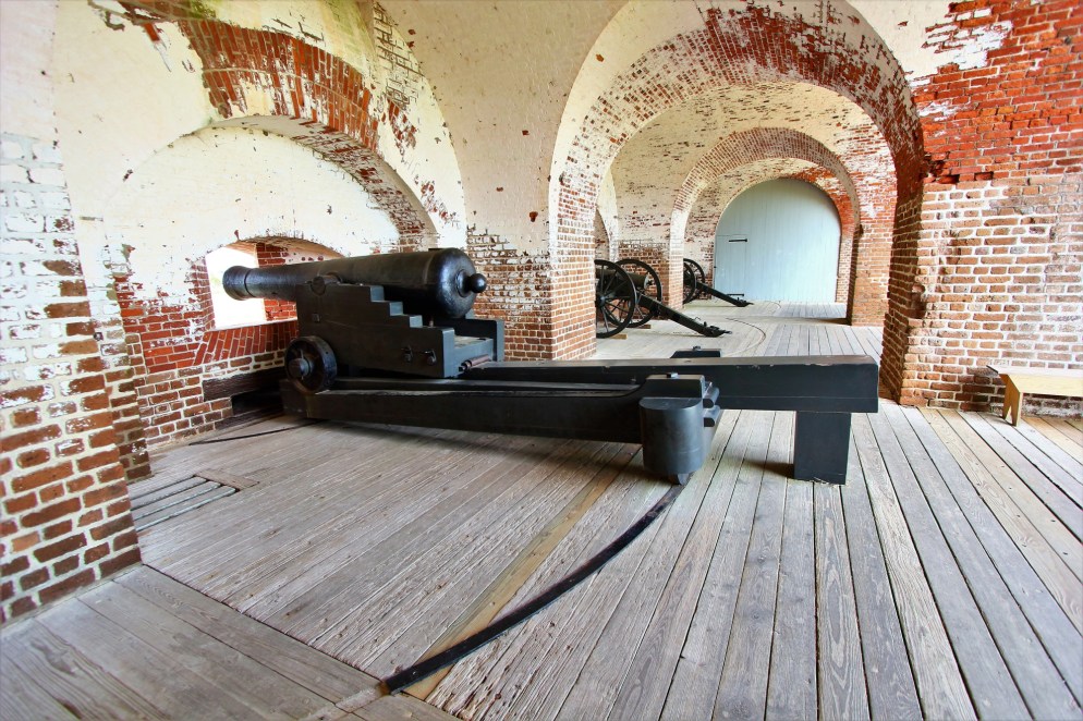
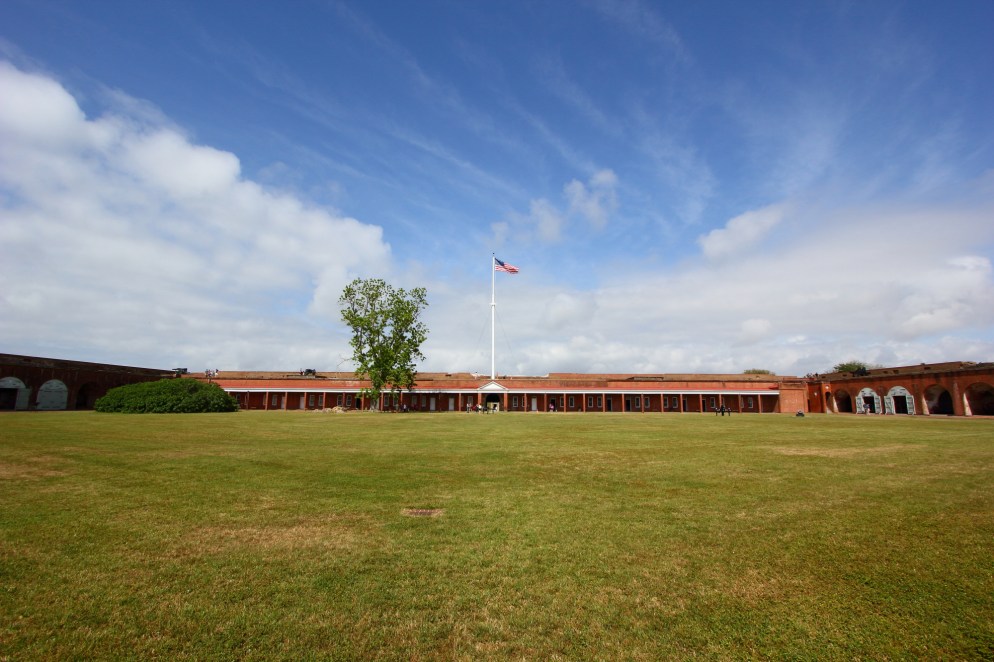
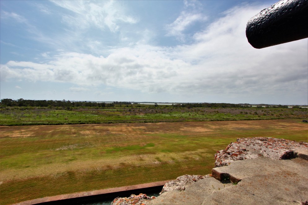
We next traveled a short distance down the Savannah river to Fort Pulaski National Monument. Yes, another fort. This one was pretty interesting. Like many coastal masonry forts in the US, it was build in response to the War of 1812, where British had relative ease landing at cities like Washington, but were stopped outside of Baltimore by Fort McHenry. President James Madison began construction on a series of forts all along the Atlantic and Gulf Coasts (including Fort Morgan we previously visited) in the hopes of preventing foreign invasion. Fort Pulaski sits on an island at the mouth of the Savannah River and protects the city from naval incursions. In August of 1829, Robert E. Lee, fresh out of West Point, was sent to Georgia to take part in the early stages of the fort’s construction. With walls 11 feet thick, Lee remarked that “one might as well bombard the Rocky Mountains as Fort Pulaski.” [That’s called foreshadowing.]
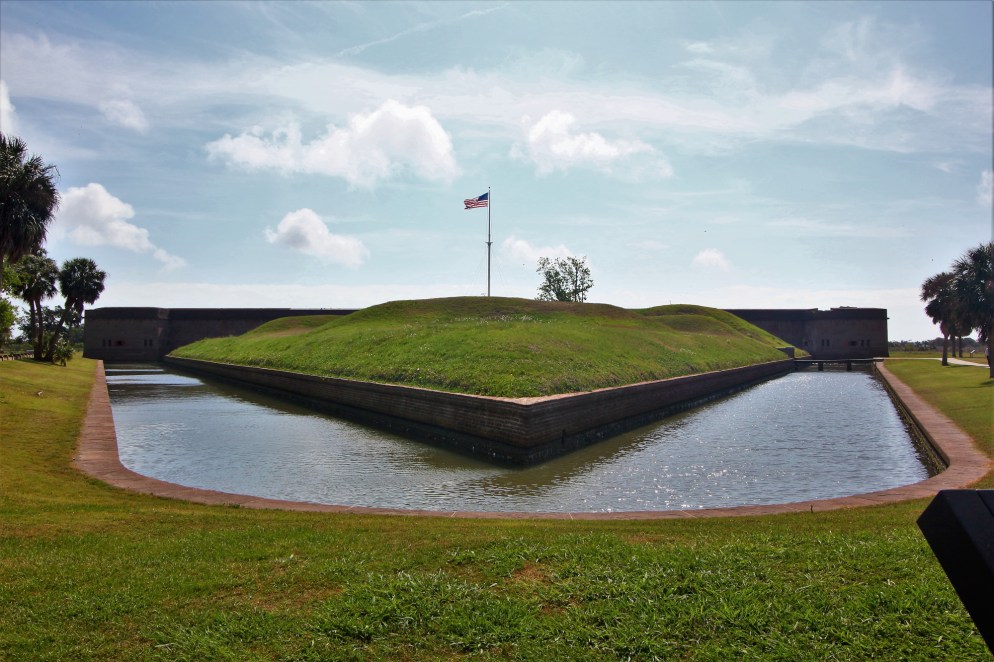


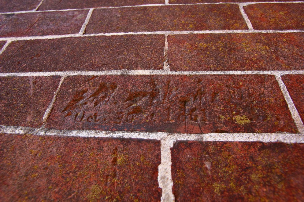

Before the first shots of the Civil War were fired, a Georgia militia seized Fort Pulaski to protect Savannah from Union attack. The Confederates did not believe the nearby barrier island of Tybee was defensible, so they abandoned it. Pulaski was more than a mile from Tybee Island, well beyond the range of cannons of the day, and the Confederates could protect Savannah from the sea from Pulaski without it.
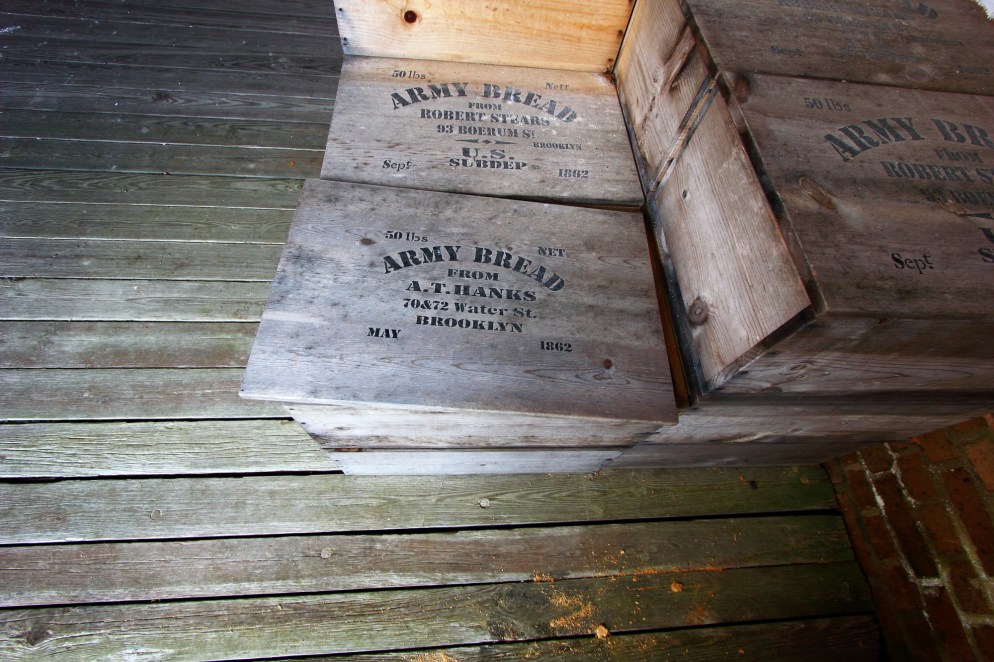
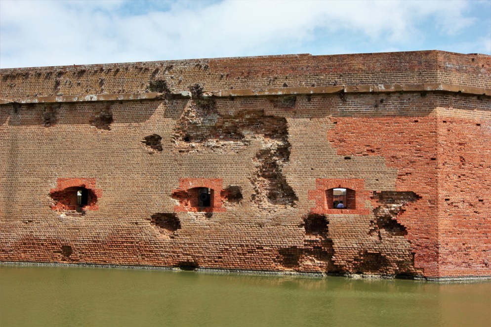
Unbeknownst to the Confederates, however, the Union was placing into service rifled cannons, with an accurate range of more than 4 miles. The Union built batteries along Tybee Island in sight of Fort Pulaski. On April 10, 1862, the Union commander asked the Confederate commander to surrender. The Confederates refused. The Union opened fire with 36 guns. The high powered rifled projectiles quickly began damaging the walls of the fort. After about 30 hours, a section of the wall began to crumble, and shells began passing through to the back inside wall of the fort, where the powder magazines sat. After a few shells smashed into the reinforced walls protecting one of the magazines, the Confederate commander decided to surrender his lost cause, rather than have his commission blown up from the inside.

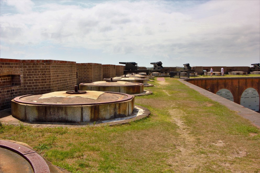

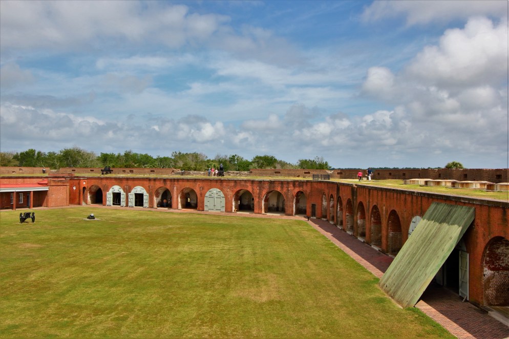
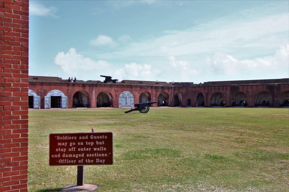
You can see the damage below. The central section of wall was rebuilt by the Union Army to re-secure the fort after they occupied it.
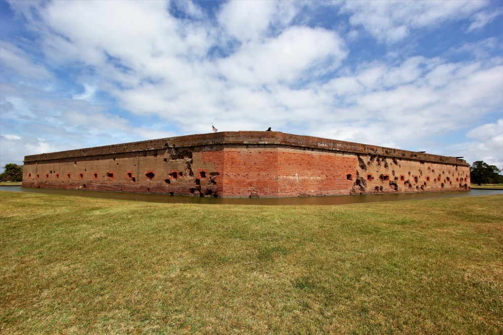


Like the Battle of the Monitor and Merrimack, the destruction of Fort Pulaski was recognized as a sea change in military technology. With the advent of rifled cannon, the world’s masonry forts were made obsolete overnight.
After Fort Pulaski, we drove out at Tybee Island, where folks in Savannah go to the beach. With none of the historical pretense of Jekyll Island, Tybee is a pure beach getaway town, with tacky souvenir shops, over priced restaurants, a nice beach, and no one taking anything too seriously.
So, that’s it for Georgia, for now anyway. Thanks for following along!

One thought on “Our House in Coastal Georgia”