July 12, 2016: Our Minnesota readers will mostly be quite familiar with the territory covered, but the rest of you may find some surprises.
On June 27, we set out to do a few days of hiking and camping.
Jay Cooke State Park
We made our first stop about two hours northeast at Jay Cooke State Park, near Carlton, Minnesota. Sitting on the St. Louis river, this beautiful park was significantly impacted by flooding a couple of years ago (including destruction of its swinging bridge). It seems largely back in order now. [click photos to enlarge]


You’ll notice that many rivers in Northeast Minnesota look like tea. That brown isn’t silt, it’s humic acid, from decayed organic matter in the bogs and wetlands that feed the area’s rivers. The water, like tea, is clear but tinted.
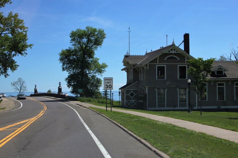
Duluth
Hike completed, we continued north to Duluth. It’s location is stunning, on high hills that come right down to the shores of Lake Superior. It is a seaport, accessible to the Atlantic through the Great Lakes and Saint Lawrence Seaway, and sharing Superior Bay on the mouth of the St. Louis River with Superior, Wisconsin; Duluth on the north shore, and Superior on the south. The bay is protected by Park Point (also called Minnesota Point), a 7 mile long sand bar peninsula, and Wisconsin Point, a 3 mile long sandbar peninsula. As the natural channel out onto the lake is significantly closer to Superior’s harbor facilities than Duluth’s, Superior was initially in primary position to profit from the bay’s position as a seaport in the middle of the continent. However, much to Superior’s chagrin, Duluth cut a canal through the base of the Park Point bar in 1871, allowing ships a direct route from the lake to the city’s port facilities. The decline of the lumber and iron ore industries, combined with railroads and trucking have diminished Duluth-Superior’s importance as a shipping center from their prime, when the cities accumulated great wealth from shipping. Luckily, much of Duluth’s prosperous Victorian architecture remains.
It’s always a bit of a thrill to crest the last hill and see Lake Superior ahead:

We’ve been to Duluth several times in the past, but never in an RV. We camped at Lakehead Boat Basin, a marina that in the summer rents out the pads where boats are stored in the winter. While the individual sites are really just a parking space with electric and water hookups, the surrounding scenery was fantastic and you can’t beat the location for exploring Duluth. [click to enlarge]


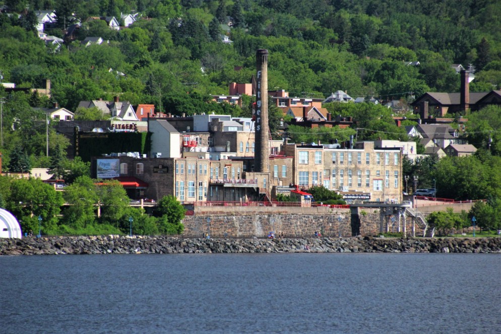
This marina, just across the aerial lift bridge from Canal Park, is the prime tourist area of Duluth. It’s a former warehouse district sitting between downtown and the canal. Since the 80s, it has been developing into a very nice tourist destination while maintaining much of its original architecture and maritime feel. [click to enlarge]


There’s a great lakewalk (along the lake of course) where people walk, run, and ride goofy bikes. [click to enlarge]


And there’s also lots of iconic oceanside scenery. Though technically no ocean, Lake Superior is big. Really big. 350 miles long, with an average depth of 483 ft (147 m), the lake is really an inland sea. [click to enlarge]


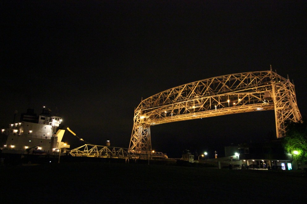
One of the most iconic sights in Duluth is its Aerial Lift Bridge, built in 1905 to allow road traffic down Park Point while still allowing large ships to enter the harbor by lifting the entire road deck 135 feet into the air. [click to enlarge]


Exploring Canal Park, we came upon Vikre Distillery which was offering a free tour. We decided to check it out. We hadn’t toured a distillery before and while this one is quite small, it was fun to learn about the distillation process. [click to enlarge]


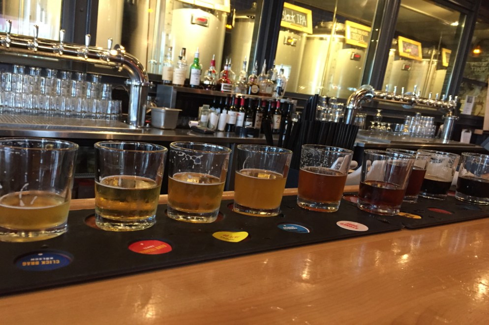
No surprise, we also found a couple of brewpubs, Canal Park Brewing Company and Fitger’s Brewhouse.
We also made a stop at Northern Waters Smokehaus. It’s been featured on at least one cable food show. But we didn’t find it until a couple of years ago. They sell smoked fish from the lake (a major regional tradition) but also make their own lox and various cured meats. It’s well worth a stop. It might be well worth a drive to Duluth.

Before heading up the North Shore (as folks here call the shore of Lake Superior north of Duluth), we drove down Park Point, away from the city. [click to enlarge]


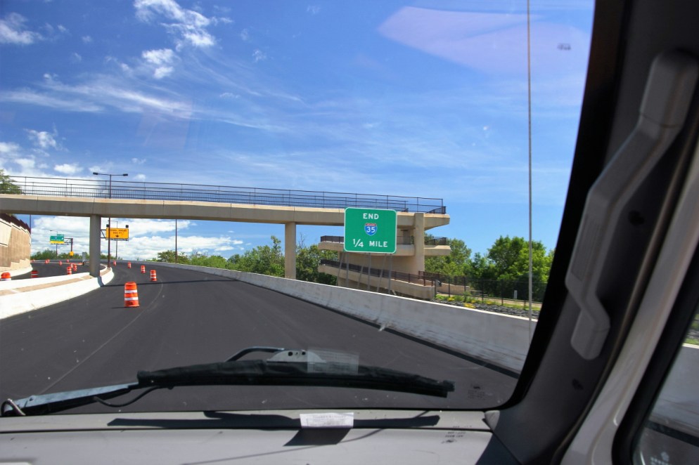
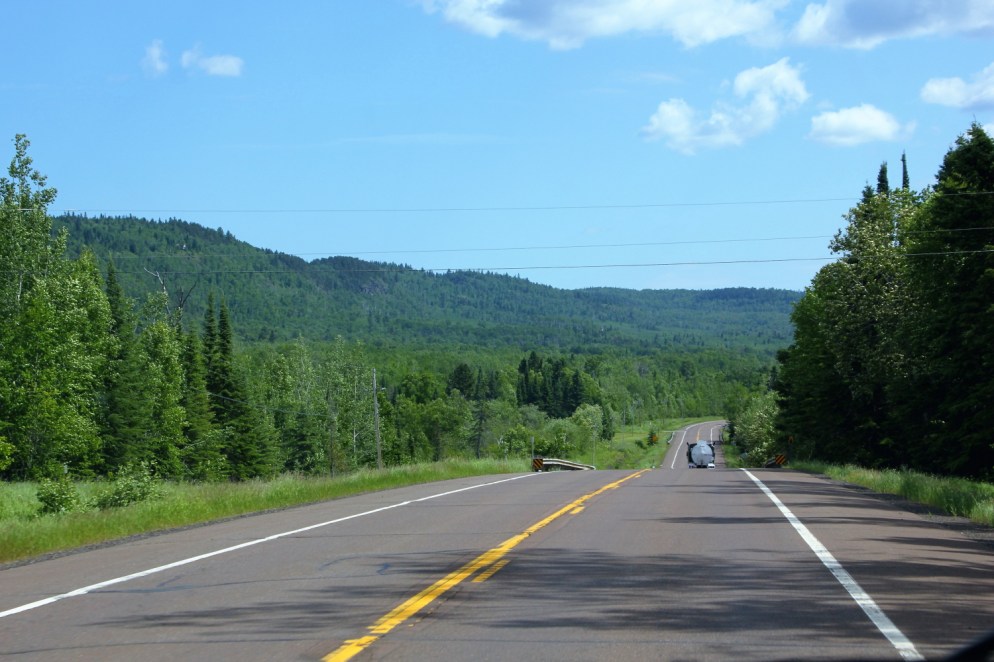
More hiking was definitely on the agenda for the day. Getting to that, we headed north, past the end of the Interstate, and onto the North Shore.
We also made a quick stop in the town of Two Harbors at Castle Danger Brewery (formerly situated in the intriguingly named nearby town of Castle Danger). We grabbed a growler and were on our way. Beer culture is booming in Minnesota!

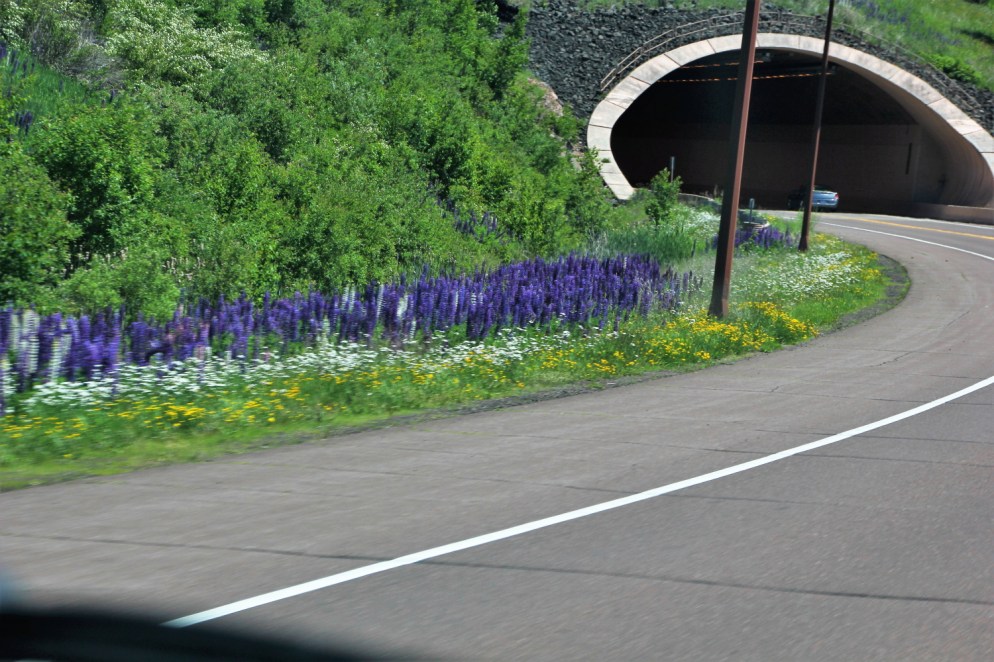
Tunnels and wildflowers heading north:

At Silver Bay, we see a surviving remnant of Northern Minnesota’s once massive iron ore mining and processing industry:


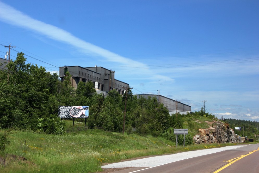
Minnesota’s Iron Range runs roughly parallel to the north shore of the lake about 75 miles to the southeast. The ore is mined on the range and sent by rail to Duluth and other ports (such as Silver Bay) where it is loaded onto ships for transit on the Great Lakes, initially to the steel mills of Ohio and Pennsylvania, but now globally. At the height of the American steel industry in the early 1970s, the majority of the world’s iron ore was mined in Minnesota. In the intervening years, the industry has shrunk dramatically, leading to economic hardship on the Range. However, the industry still survives, and has even been expanding recently, as ore is shipped overseas for steelmaking. Minnesota’s iron ore production is a scant 10% of its early 70s heyday, nevertheless it still accounts for the majority of America’s iron ore production.
Tettegouche State Park
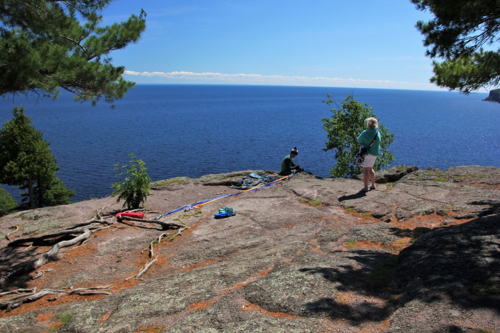
We made our next stop at Tettegouche State Park. The scenery in this area is stunning, all cliffs and trees and pebble beaches. [click to enlarge]


We hiked up to Shovel Point (we have no idea why it’s called that). We climbed up many, many steps along this impressively fancy trail, with great views of Lake Superior’s rocky shores and crystal clear water. [click to enlarge]


At the top we found rock climbers taking advantage of the cliff face.


Cascade River State Park
Our next stop was Cascade River State Park, where we camped for the night. Though we were looking for campsites on a Tuesday, and there are several state parks in this area, this was the only park with availability, possibly because the park’s shower / restroom facilities are out of commission for the season. We have our own, so this didn’t cause us any concern.
The bulk of this park heads inland from Lake Superior along the Cascade River. The two meet here:

Although this river is named for its falls, all the rivers up and down the North Shore have falls, as they cut their way through the hard rock down to the lake. [click to enlarge]


After a night of traditional camping with a wood fire and all, the next morning, while looking at Facebook, Laura discovered that some friends from Saint Paul were camping in the same campground, just a couple of campsites away. We made the trip over to say hell0 – they were pretty surprised to see us since they thought we were still in Mexico!
We continued the adventure into the north woods.
We stopped at a scenic overlook. There were some helpful maps pointing out our location. [click to enlarge]


There’s no end to incredible scenery in this area. [click to enlarge]


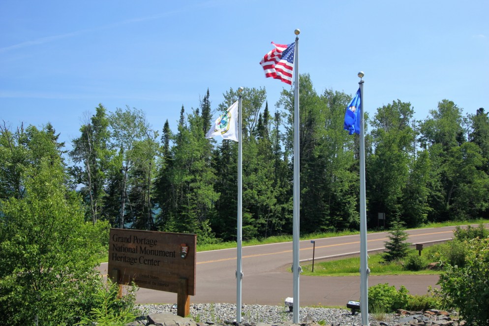
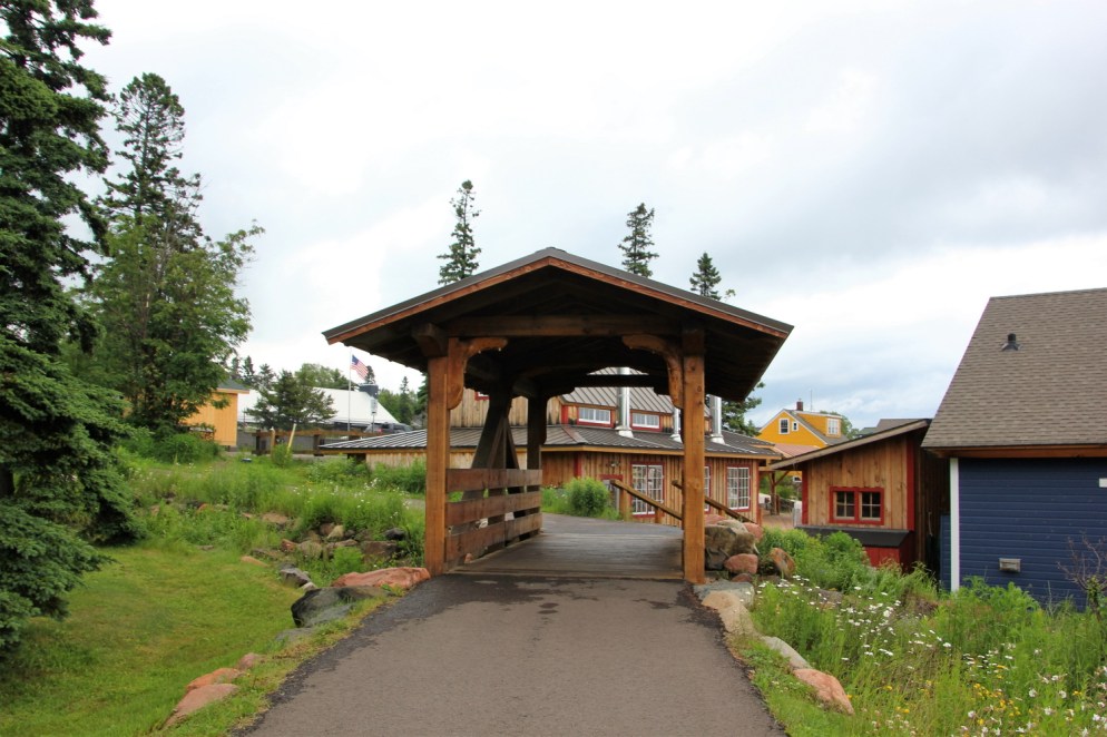
Grand Portage National Monument
Heading further north we came upon the Grand Portage National Monument. This site, operated by the National Parks Service, is a historic commerce site for the fur trade, which was a booming business at the turn of the 18th century. With short overland portages between waterways, Native Americans were able to conduct trade by canoe from the Atlantic to the Canadian Rockies. The Grand Portage was a trail approximately 8.5 miles (32km) long, bypassing falls and rapids from the shore of Lake Superior to the Pigeon River, and from there into the interior of the continent. During the 18th Century, European traders, primarily French Canadian Voyageurs, extracted massive quantities of furs from the northern forests of North America, most notably beaver fur for hats. At the Grand Portage site on the shore of the lake each year was held a Rendezvous, a meeting of the trappers bring their furs down from the interior, and the Voyageurs from Montreal who brought the furs back to the Montreal along the great lakes in giant cargo canoes. The Rendezvous involved as many as a thousand men, and lasted several weeks of trading, and celebrating.
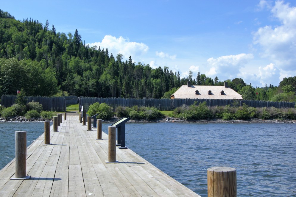
The site recreates some of the features of the Northwest Company’s post at Grand Portage as it would have been at the end of the 18th Century.
Outside the stockade were native birch bark lodges. The kids are playing with a lacrosse ball they assembled from traditional materials with help of Native American docents.


In a recreated storage building, docents dressed as Voyageurs discuss the trade. From the rafters hang demonstration canoes of various sizes build by these same folks.


The recreated stockade, with kitchen building and great hall. Other buildings would have occupied much of the area within the stockade:


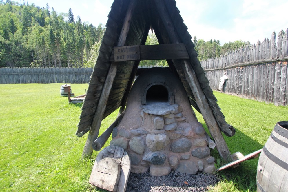
Wood oven for bread. There would have been dozens of these ovens to feed 1000+ people.
Great hall set for dining, and trading room with examples of the furs traded: [click photos to enlarge]


Grand Portage State Park
We next visited Grand Portage State Park. This park sits on the Canadian border. In fact, you can see the border checkpoint from the park’s entrance.

This park sits along the Pigeon River, which forms the U.S.-Canada border. The far bank of the river is Canada. [click to enlarge]


We did more hiking, first along this very fancy trail to this waterfall, the highest in Minnesota.

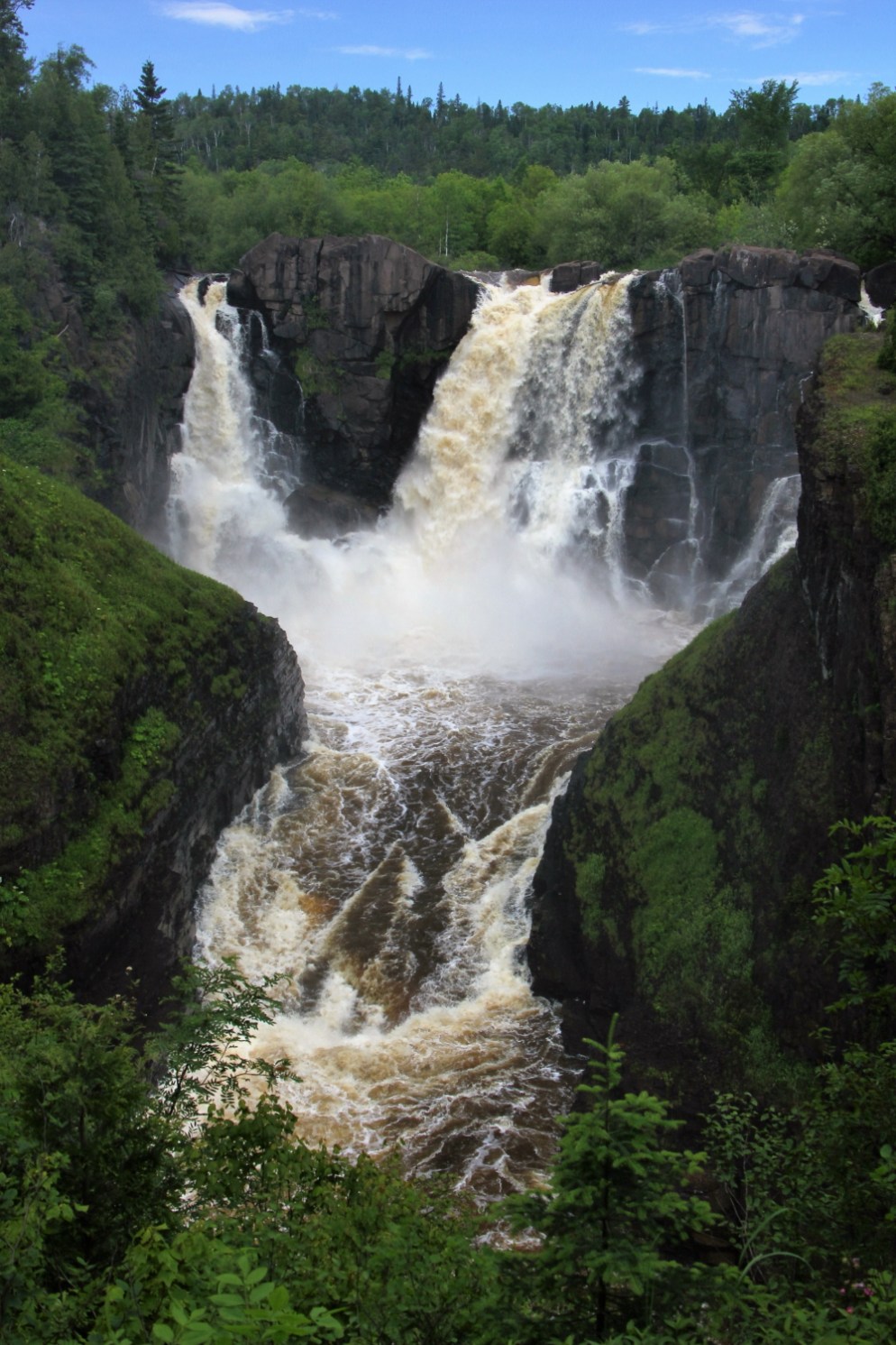
After that, we hiked to smaller falls.
Along this trail the gravel is interesting, composed of local rock that cleaves in rectangles that look more like wood chips than stone. [click to enlarge]


Before setting out, Laura asked park staff whether the trail to the upper falls was worth the 5 mile round trip. We were assured that if we enjoyed hiking, it was. The trail was not so fancy, and we had ankle-deep mud for much of the 5 miles. It might have been nice to know that in advance. But of course if we had, we would have missed this scenery. [click to enlarge]


And you would have missed these moments of flowing water zen.
That standing curl was strangely hypnotic.
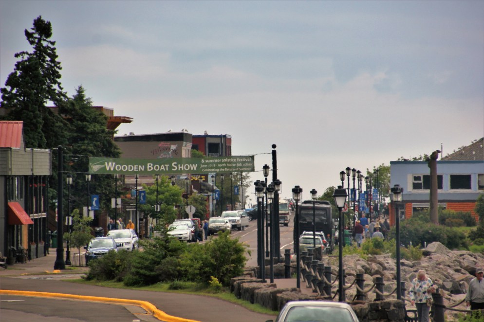
Grand Marais
Grand Marais is a North Shore gem that we first visited together during Laura’s first visit to Minnesota, 20+ years ago. It’s a charming little town reminiscent of something you might find along the coast of New England, with a good dose of moose decor to remind you that you’re in northern Minnesota.
There’s plenty of smoked fish. [click to enlarge]


And you won’t have any trouble finding a brewpub or interesting restaurant. [click to enlarge]


For our last night up north we camped in Grand Marais’s municipal campground, which sits right on the harbor. [click to enlarge]


We encountered some RVs even older than ours! [click to enlarge]


Before leaving town, we took a stroll to take in the sights. Initially it was cloudy, but there was not really any fog. [click to enlarge]


As we continued the walk, the fog rolled in, slowly consuming the sailboats and scenery along the shore. [click to enlarge]


It was a good adventure “up north.” Now back to the Twin Cities to catch up with more friends and family. We’ll tell you more about our continuing Midwest adventure next time.

My old stomping ground! And I love Northern Waters. They make this sandwich with housemade chorizo and pepperoncini that I lived on while pregnant with J.
LikeLike
Laura, give me a call so we can get together, I will buy you a beer.
LikeLike
Nice tour of the North Shore, I’ve hiked up there for decades. Try the Superior Hiking Trail sometime -it runs from down by Jay Cooke up to Canadian Border. I’ve been to Nerstrand Big Woods too. Lots of nice pictures. I’ll stop back again.
LikeLiked by 1 person
Perfect. Great tour guides. We will follow you map and highlights on our next trip to the north shore plus see if we can find a few additional gems. Dad
LikeLiked by 1 person